There is a distinct kind of magic that occurs when lifting the lid of an archival storage box that has remained untouched for decades. Inside lie the fragile physical anchors of our collective past—cracked glass-plate negatives, ink-stained survey maps, and meticulously hand-drawn architectural blueprints. When exploring the Glendale historical society archives, researchers do not just read about the past; they touch the tangible paper records left behind by the architects, surveyors, and homesteaders who shaped the landscape.
The 1906 Townsite Boom: Mapping the Grid
Before Glendale officially incorporated as a city in February 1906, the region was primarily a patchwork of sprawling agricultural ranches, citrus groves, and open valley land nestled against the Verdugo Mountains. However, the arrival of Pacific Electric red streetcars promised a new era of rapid suburban expansion, connecting the quiet valley directly to downtown Los Angeles.
Newly cataloged documents within local historical collections reveal the ambitious scope of this transition. Original real estate prospectuses and hand-drawn survey maps from 1906 show how land developers meticulously carved the open acreage into uniform residential lots and commercial blocks centered around Brand Boulevard. These paper maps offer a fascinating glimpse into the optimism of early promoters, charting thoroughfares that existed only as chalk lines on parchment before a single hammer struck wood.
Architectural Blueprints of Early Residential Design
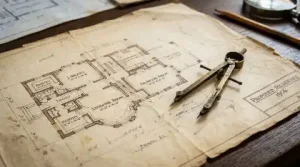
Beyond broad regional planning maps, archival boxes hold intimate treasures: the original residential blueprints commissioned by Glendale’s earliest homeowners and contractors. Examining these fragile, cyanotype blueprints provides profound insight into early 20th-century construction methods and domestic lifestyle ideals.
Pioneer architects working in Southern California during this period heavily favored practical, climate-adapted designs that would soon evolve into the iconic California Craftsman bungalow. The blueprints detail deep overhanging eaves designed to shade windows from the harsh summer sun, expansive front porches meant for evening socializing, and cross-ventilation layouts that captured cooling canyon breezes.
Notes scribbled in the margins by master carpenters indicate adjustments made on-site, substituting imported materials with locally sourced timber, river stone, and stucco. These annotations transform a flat architectural drawing into a living narrative of human decision-making and craftsmanship.
Glimpses from the Glass Negatives
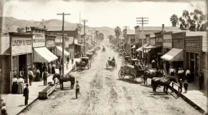 Photographs preserved in local archives act as a visual time machine, freezing fleeting moments of daily life during Glendale’s incorporation year. Among the most remarkable discoveries are high-resolution scans from early glass-plate negatives capturing the nascent commercial district along Brand Boulevard.
Unlike modern digital photography, capturing an image on a glass plate required heavy equipment, deliberate exposure times, and meticulous chemical processing. Consequently, the people captured in these street scenes—merchants standing proudly outside wooden storefronts, children riding bicycles on dirt tracks, and families boarding horse-drawn buggies—pose with a quiet, striking dignity.
These images dispel the notion that early Glendale emerged overnight. They document the messy, energetic reality of a community under construction: lumber stacked on muddy corners, makeshift canvas awnings shading dry goods, and surveyors peering through transits against the backdrop of untouched mountain slopes.
The Critical Importance of Archival Preservation
The survival of these irreplaceable documents is no accident. Historic paper, blueprints, and photographic negatives are highly susceptible to environmental degradation, light damage, and acid deterioration. Archival preservationists work tirelessly in controlled repository rooms, utilizing acid-free enclosures, specialized climate controls, and careful digitization protocols to ensure that these physical artifacts endure.
Preserving local history is essential for maintaining community identity. When modern residents understand the physical evolution of their neighborhoods—from Spanish land grants to streetcar suburbs and modern municipalities—they develop a deeper stewardship for surviving historic architecture and urban landmarks.
For researchers and preservationists seeking broader methodologies in historical conservation and archival management, organizations such as the National Archives provide foundational guidelines on document preservation, while regional studies can be explored via the California Historical Society.
Connecting Past Foundations to Future Preservation
Uncovering the blueprints and photographs of Glendale’s 1906 townsite boom reminds us that every historic building, street corner, and park has a documented origin story written by individuals who envisioned a thriving community in the arid valley.
As we continue to catalogue, study, and protect these archival treasures, we honor the physical foundations upon which our city was built. Exploring these records invites every resident to look past modern asphalt and concrete, recognizing the rich, carefully mapped history that lies just beneath the surface of everyday life.